If rush hour has brought traffic congestion to your previously quiet neighborhood, you’re not alone. City planners and transportation engineers nation-wide are struggling to tackle the issue of excessive use of residential roadway infrastructure.
The steep increase in the use of residential streets as major thoroughfares is largely attributed to navigation via the WAZE app, and the ever-increasing number of vehicles on roadways due to ride sharing services such as Uber and Lyft. The job of mitigating the effects of these suburban roadway nuisances is getting costlier and more time consuming, but there are new tools that provide insight into traffic flow improvement, including AI empowered traffic analytics and drones that can capture miles of video content and photos in just minutes. These new tools provide valuable insight regarding traffic patterns and to validate traffic studies.
The most recent iterations of traffic and travel analytics provide multiple survey tools, such as vehicles count and time in intersections, vehicle class sorting, and AI applications that will adjust the timing of traffic lights to ensure safe pedestrian travel through crosswalks. These Smart City traffic integrations provide real-time and historical data regarding traffic conditions, which allows for better roadway expansion planning.
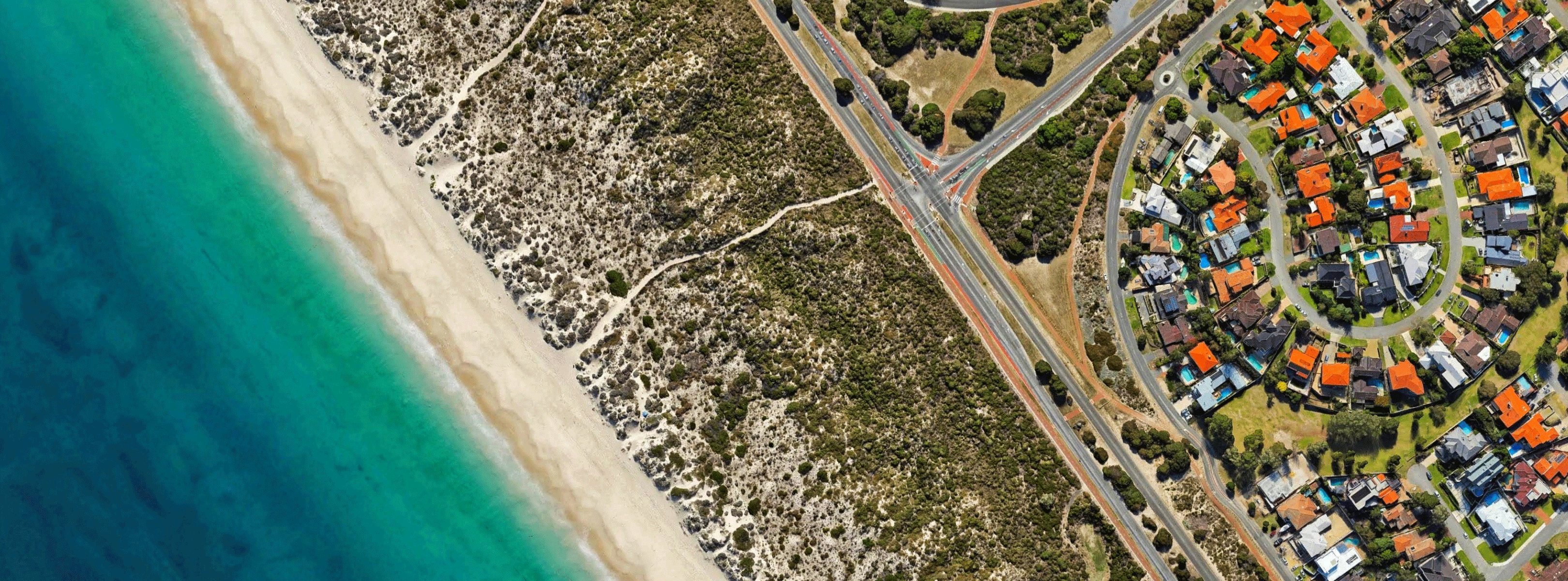
Although tabulation and reactive traffic analytics are great tools, they are not always the complete solution for accurately verifying vehicle counts or for understanding the traffic flow and use of residential streets. Regarding verification of traffic counts, the top-down view of traffic allows the most accurate, unobstructed view of traffic flow, including the detail needed to classify vehicles. This is very important in order to produce the most accurate independent verification of traffic counts conducted via available analytics.
This view also offers the unobstructed view of intersections required for traffic analytic image capture; large trucks and buses can easily hide smaller vehicles, creating errors in counts and in calculating the movement of vehicles. The view from a drone camera also provides a wide, multi-block view of neighborhoods, allowing easy tracking of traffic patterns and use of residential roadways.
Finally, a drone can be tethered to a power supply and positioned above an intersection, providing the continuous capture of traffic flow for days or weeks.
As traffic analytics and drone data capture technologies are adopted by cities to measure traffic flow and to create mitigations and solutions for pedestrian safety and infrastructure overuse, data will become easier to collect, classify and track. These are benefits we can all get on board with!