Maps have been around for thousands of years in one form or another. But only recently have they become powerful tools for organizations looking to make better sense of their operations.
Before the rise of drones made aerial imagery relatively cheap and accessible, a reliance on manned aircraft and satellites restricted the benefits of mapping to businesses that could afford the expense and those who saw value in data at that kind of scale.
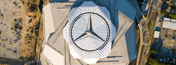
Now, drones represent a more versatile way to gather data at lower altitudes, and solutions in a number of industries have developed as a result. From farmers lowering costs and maximizing crop yields to construction project coordination and mine inspections, more and more organizations are using drones to create detailed maps and make better decisions.
So what does mapping actually mean?
The mapping process is essentially a combination of photography and smart software. A drone will fly above a site on a predefined path at a consistent altitude, taking a series of photographs to capture every inch of ground.
Then, software steps in to stitch all of those photos together and build a cohesive map that organizations can use to judge progress, assess a situation and plan for the future.
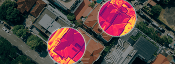
The quality - and usefulness - of the end result depends on a number of factors: the particular use case, the resolution and number of images taken, the altitude of the drone during the flight, the light conditions, the amount of overlap between images and ground control points - even the pitch of the gimbal can make a difference.
Which software does DroneBase recommend?
There are a few software providers leading the way in the drone mapping space. Choosing between them will depend on the exact details of the mission at hand and the needs of the client in question.
Our favorites are Pix4DCapture and DroneDeploy. Both platforms allow you to plan flights and gather the data clients need to build comprehensive maps of projects and work sites.
Both are also flexible in terms of adjusting your flight parameters and monitoring the progress of missions as they unfold.
Importantly, Pix4D’s platform allows for gimbal adjustment during the flight plan phase. This is key for clients that are concerned with the depth in their orthomosaic maps, such as those whose terrain comes with elevation changes.
What gear do you need to take on a mapping mission?
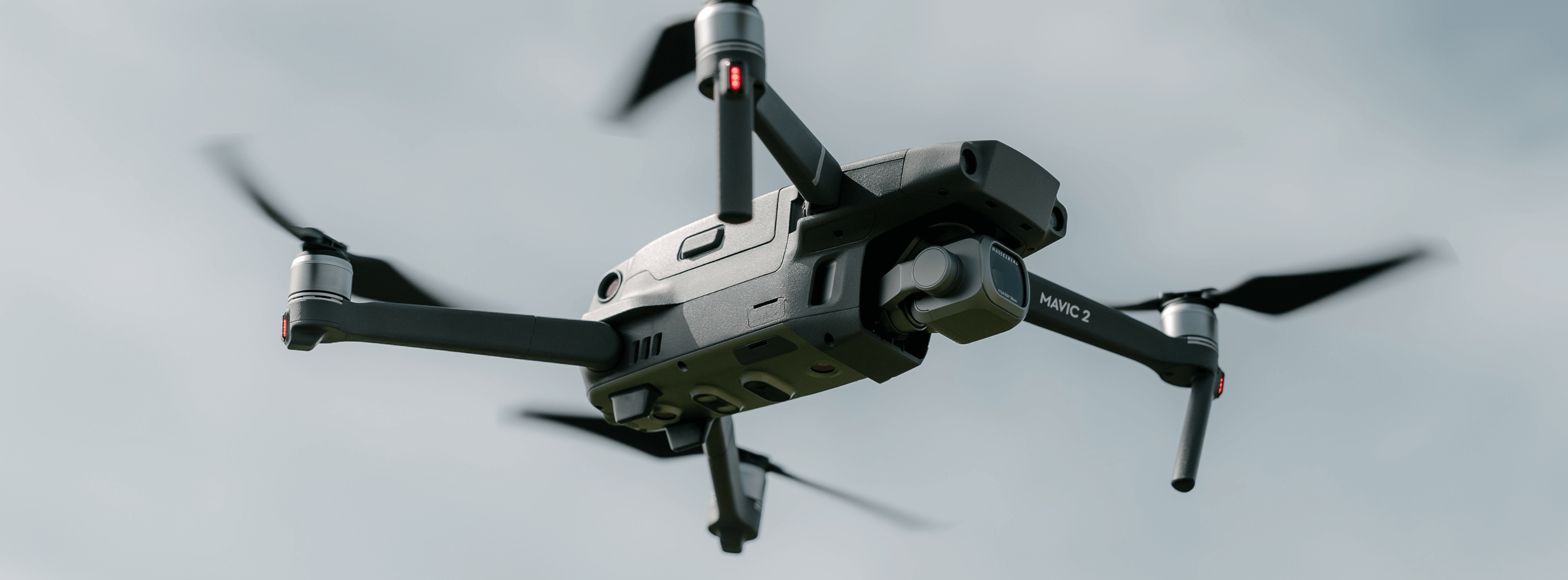
If you’re planning to take on a mapping mission for a client, you’ll need a drone with a high-resolution camera and a mechanical shutter. We recommend the Phantom 4 Pro, the Phantom 4 RTK or the Mavic 2 Pro.
You’ll also need a mobile application such as those offered by Pix4D or DroneDeploy, which you can use to plan your flight and make adjustments to ensure you get the data you need to produce the map you want.
As with any mission, it’s worth taking plenty of spare batteries. Mapping can take time and require multiple flights. You don’t want the end result to be compromised because you lost power halfway through.
If you’re carrying out a mapping mission for DroneBase, you don’t need to worry about the time-consuming post-production element. Just carry out your flight, upload the data and we’ll handle the process of stitching the photos together.
Planning with the weather in mind
It’s important to choose your day and flight path carefully when collecting images for a mapping project. You’ll need to check for obstacles that could disrupt the process and adapt accordingly.
The weather conditions are also vital. To produce high-quality maps, image detail is everything. Poor lighting is one factor that can negatively impact the usefulness of your end result. Light consistency is also key. If the sun is coming and going with rolling cloud cover, spots of shadow could reduce the quality of your final map.
The same goes for motion blur. On a windy day, your images might suffer if the drone is unstable in the air or if things on the ground, such as crops, are moving too much.
So plan in advance, and do what you can to fly while the sun is high in the sky and the wind is calm.
For more information about the gear we suggest for mapping missions and the hardware that can take your pilot career to the next level, check out our recent post on upgrading your equipment.
You can also learn more about DroneBase Mapping Missions specifically at this Pilot Guide.